
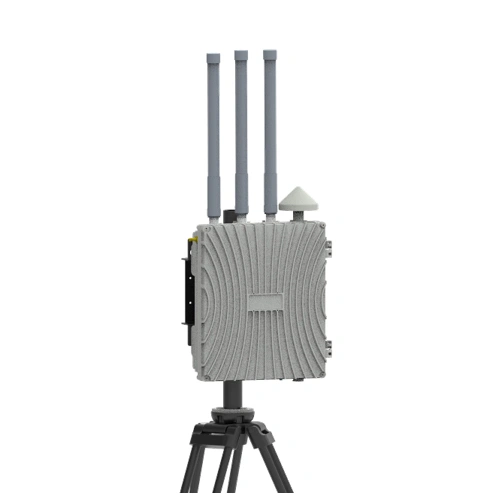
LSDF-020 Low-Altitude Electronic Eye
ProductFeatures1.TrajectoryTracking:IdentifiesUAVIDsandtracksthereal-timelocationoftheaircraftandpil
Product Features
1. Trajectory Tracking: Identifies UAV IDs and tracks the real-time location of the aircraft and pilot.
2. External Devices: Supports network fusion detection data with spectrum, radar, optoelectronic, and other devices.
3. Detection Quantity: Supports detection of ≥20 UAV targets and trajectories.
4. Transmission Mode: Supports wired network or 4G wireless network connection.
5. Information Sharing: Real-time sharing of data information between different grid units.
6. Blacklist/Whitelist: Effectively distinguishes between cooperative and non-cooperative UAVs.
7. Unattended Operation: 24/7 unattended operation with automatic monitoring.
8. Data Fusion: Intelligent processing of multi-grid data classification for convenient decision-making.
9. Large-Area Grid Deployment: Enables refined management and avoids redundant construction.
Product Parameters
| Item | Technical Specification |
| Detection function | Remote Identification, Packet Resolution, Spectrum Detection (Optional) |
| Detection Range | 1∽3km (depending on working conditions) |
| Identify parsed information | Including drone SN code, speed, altitude, position and other information and the location information of the pilot |
| Detection angle | 360° omnidirectional |
| Spectrum sweep bands | 400MHz、800MHz、900MHz、1.4GHz、2.4GHz、5.2GHz、5.8GHz |
| Operating temperature | -30℃~70℃ |
| Communication mode | Ethernet/4G |
| Maintenance method | online upgrade |
| Power supply range | AC220V/DC48V/solar powered |
| Working hours | 7×24H |
| Enclosure protection level | IP66 |
| Device weight | ≤5kg |
| Detection function | Remote Identification, Packet Resolution, Spectrum Detection (Optional) |
Application Areas
It can be deployed on ground facilities such as monitoring poles, light poles, and base stations in the form of hoops, or it can be deployed separately on the roof of the building.
It can realize grid global deployment within the city; It can also be combined with the following special areas in combination with jamming strikes, navigation and deception and other key protections: Urban sensitive areas: all-weather real-time monitoring of airports, energy facilities, and government buildings Large-scale event support: real-time monitoring of drone threats for sports events and political meetings Border field protection: rapid positioning of illegal cross-border drones.
Basic Edition: Remote Identification + Message Parsing
Enhanced Edition: Basic Functions + Spectrum Detection
Field Edition: Solar Power Supply + 4G Access